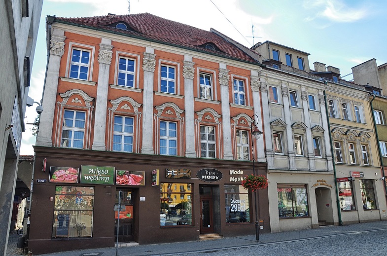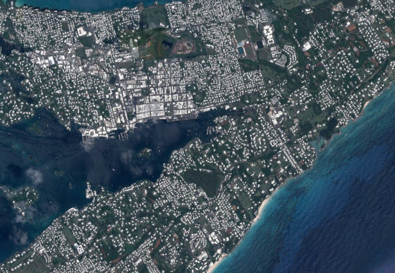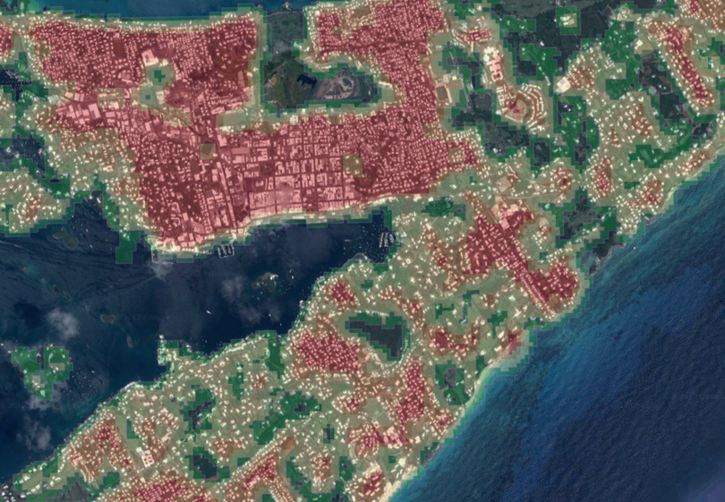
Street-Level image analysis
Automatic feature extraction from street-level images using the latest advancements in deep learning technologies. The developed service named Deep Property (aka CountFloors)(LINK HERE) system allows very fast, large-scale analysis of urban environment for many different application fields, such as risk management and real estate services. The retrieved features are attached to each building footprint polygon in a bespoke - or standard- GIS layers. Our services can boast:
- Very Fast processing times, e.g. less than 4 hours for an entire city the size of Milan, Italy
- Coverage at global scale thanks to different possible data providers
- High Confidence Level (>95% overall accuracy in actual tests)
- Single-Building-Scale spatial focus
- High Scalability
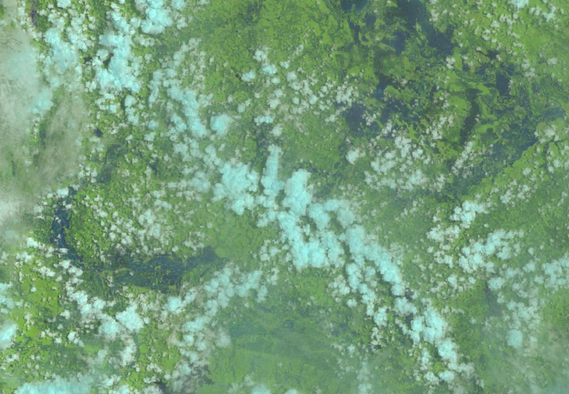
SAR data analysis for emergency management
SAR data is characterized by two main operational advantages, which are: day-and-night capability, and cloud penetration. These pros are crucial in emergency situations where rapid mapping of damage, together with monitoring of the aftermath, is critical for reliable damage assessments and provision of emergency services. In this field we can contribute:
- Long-term experience in handling SAR data
- Large-Scale analysis
- Development of Ad-Hoc algorithms and toolsl
- Tight partnership with a new, groundbreaking SAR data provider
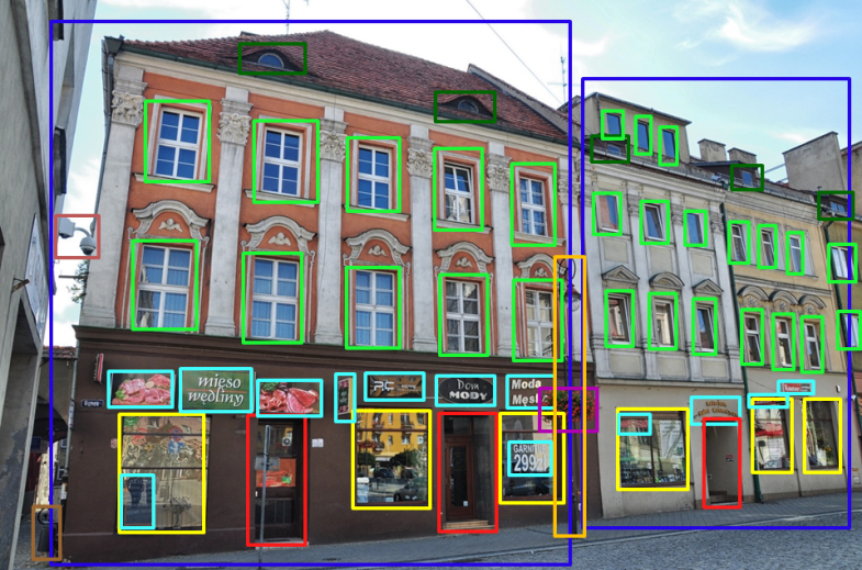
Image-Object detection and Classification in spaceborne data
The volume of spaceborne data produced every single day keeps increasing exponentially, and so does the total amount of information which could -potentially- be ‘mined’ from it. In this deep sea of applications, two fields relevant to our know-how are: Geospatial detection and localization, and Classification. They have proved to effectively help our clients in many business areas. Our approach to this field includes:
- In depth discussion of the problem with each client, in order to understand its needs and come up with the most cost-effective results
- Reliable automatic analysis applying our long experience in machine learning techniques
- Large-Scale analysis, thanks to the nature of data and of the automated approaches
- Optimized processing, for time-effective results
- Data Fusion techniques from different sources at different scale for best results
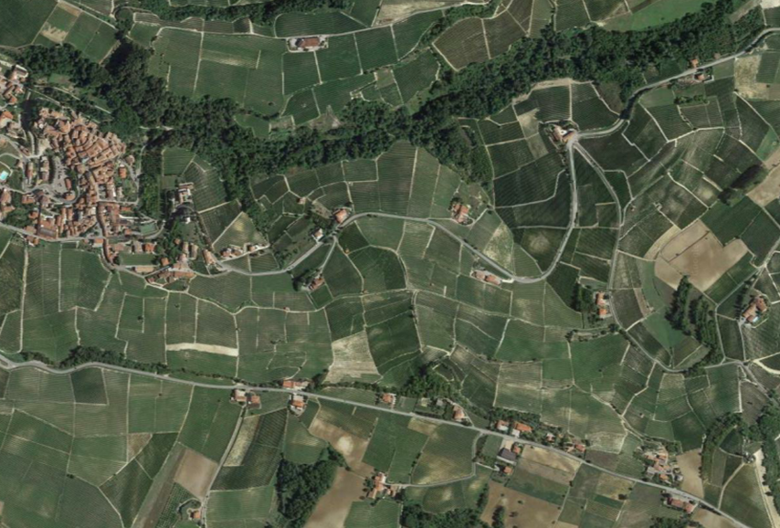
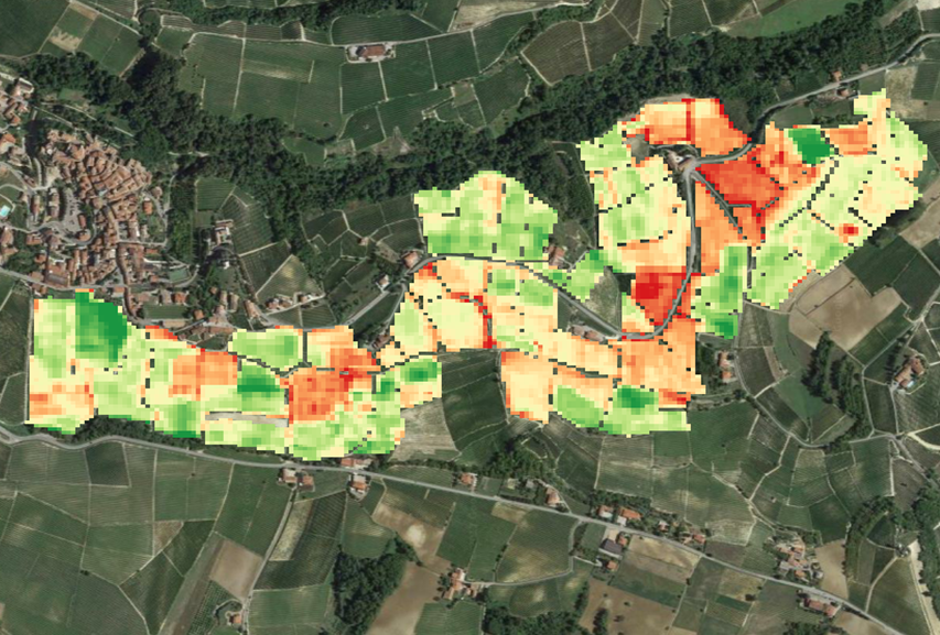
Crop Monitoring and (Quality) prediction
Food and Earth-Observation Science are never been so close as in the last few years. The use of remotely sensed data from space, and in-situ environmental data are very powerful in agriculture. Crop monitoring can help our clients in timely alerting about and in tackling effectively possible diseases appearing in their fields. Specifical, case-oriented analysis can also increase the quality of their products. Our services include:
- Developing of crop-oriented services, such as the award-receiving Saturnalia (link) system
- Crop-oriented monitoring algorithms
- Patent-based, low-maintenance weather-stations for long-term, extensive analysis of environmental conditions
- Data Fusion of in-situ and space-borne data
- Simple and effective WebGIS platform to monitor, and analyze, the collected data
Passive and Active Crowdsourcing
Nowadays, smartphones and smart handheld devices are commonplace and do collect a lot of data, which is very frequently geotagged. When shared, these data are de-facto crowdsourced, and can be clustered into two main groups which are: active and passive. The former are data collected for a specific purpose or application. Passive crowdsourcing, instead, relies on data collected for a different purpose, but which are re-used to derive information for a specific application. An example of these latter are images and data shared in Social Media sites and systems, such as Twitter © and Flickr © . In this context, our services include:
- Development of services based on Passive, and Active, crowdsourcing
- Development of ‘Apps’ for smartphones (e.g. Android, iOS); our experience includes the award-winning app “Cloopsy”, contracted by the Joint Research Centre of the European Commission (Link), available on PlayStore (Link) and on App Store (Link)
- Development of APIs (Application Programming Interfaces)
- Data Analysis and Data Fusion with different sources of data
Utilizziamo i cookie per essere sicuri che tu possa avere la migliore esperienza sul nostro sito. Se continui ad utilizzare questo sito noi assumiamo che tu ne sia felice.Ok